|
A cooperative habitat restoration program that restores wetlands on
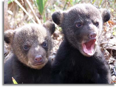
marginally and non-productive croplands recently helped produce five black
bear cub litters in Louisiana.

One den was located on a recently planted tract in Bayou Cocodrie National
Wildlife Refuge (NWR). The remaining four dens were located on privately
owned properties enrolled in the Wetland Reserve Program. This valuable
program added 10 black bear cubs to the threatened population of Louisiana
black bears.
The Wetland Reserve Program is a voluntary easement program and since its
creation in the 1990 Farm Bill, over 200,000 acres have been restored to
wetlands in Louisiana. These properties now contribute to improved flood
protection, carbon banking, and water quality, as well as wildlife habitat
for hundreds of species.
The U.S. Fish and Wildlife Service (USFWS) listed the Louisiana black bear
as a threatened subspecies under the Endangered Species Act in 1992. As
with most rare species, habitat loss and fragmentation was the primary
cause for the bear?s decline.
The USFWS Recovery Plan for the Louisiana black bear requires protected
forest corridors between bear populations and protection of existing
habitats. Since 90 percent of lands in the historic range of the Louisiana
black bear are privately owned, creating these corridors presented several
challenges for bear recovery efforts. Prior to the creation of the Wetland
Reserve Program in the 1990 Farm Bill, there was no large-scale mechanism
in place to create the forest corridor necessary for delisting.
To directly address the recovery criteria, the Black Bear Conservation
Committee, Louisiana Department of Wildlife and Fisheries, U.S.D.A. Natural
Resources Conservation Service, and the USFWS launched a landscape-scale
approach to forest restoration in order to create the corridors necessary
for bears. Large forest blocks, previously identified as high priority bird
conservation areas, were linked by corridors to encourage bear movement
between tracts.
This effort evolved the 3.5 million-acre Louisiana Black Bear Habitat
Restoration and Planning Maps (HRPM). The HRPM, reaching from the
Arkansas/Louisiana border to the Gulf of Mexico, established three levels
of conservation based on where bear populations are currently located and
how bears move through the landscape. Priority zones and a system for
awarding additional points to properties competing for the Wetland Reserve
Program and other conservation programs were established by the HRPM.
"The corridor was created with the expectation bears would use it as a
travel route from one large forest tract to another," said Maria Davidson,
LDWF large carnivore program manager. "It was unexpected that bears would
den and successfully produce cubs in these young forests. These litters
represent the success of this cooperative habitat restoration plan."
The first bear litter documented in Wetland Reserve Program lands was found
in 2004 adjacent to Tensas River NWR in northeast Louisiana. Two additional
litters were discovered in 2006, and two more in 2007. All dens were
located within the high priority areas identified in the HRPM.
Historically, bear densities in the region were highest in bottomland
hardwood forests of the Lower Mississippi Alluvial Valley (LMAV). Because
of land drainage and clearing of bottomland hardwoods for agriculture in
the LMAV, the original 24 million acres of these forests was reduced to
less than 5 million acres by 1980. Unfortunately, many of these tracts are
too wet for agriculture and considered marginal or totally non-productive
as cropland.
Although the amount of bottomland hardwood loss has stabilized since the
early 1990s, restoration of this habitat is still crucial for bear recovery
due to the highly fragmented nature of the remaining forests. Presently,
500?700 bears can be found in several relatively isolated breeding
populations in the Tensas and Atchafalaya River Basins in Louisiana.
|