The Cumberland Trail
State Park in Tennessee is a partially complete hiking trail that
will be just over 300 miles long. Secondary and spur trails will
bring that total up to 370 miles. Currently there are about 145 miles
of trail complete. However, this is not a continuous 145
complete trail section, but various sections of trail spread out along the entire 300 mile
long trail.
|
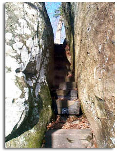
Cumberland Trail at Black Mountain |
The Cumberland Trail was
designated a State Scenic Trail in 1971 and a Tennessee State Park in
1998. The southern end of the trail is in Signal Point National
Historic Park near Chattanooga Tennessee and the northern terminus is
the Cumberland Gap National Military Park on the Kentucky/Virginia
border.
|
The following table is a segment length
list according to the Cumberland Trail Conference. I'm not sure why
the totals do not match what the trail is supposed to be when complete.
|


